As of July 2012, Dutch Geo-office Kadaster has published an update of the Top10NL topographic GIS data set. Areas of central-NL + Rotterdam have been updated. Some ‘holes’ in the terrain have now been corrected, and the new industrial port area “Maasvlakte 2” (under construction) is now visible for the first time.
The data set can be ordered at no charge through this Kadaster page (in Dutch); use nlextract.nl to convert the GML dataset to PostGIS.
In a previous article I’ve combined the Top10NL with the AHN25 Height/relief data set of 2005/2006. QGIS 1.8 supports this nicely.
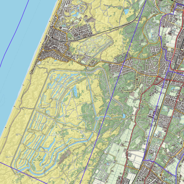
Below are two more examples, with the AHN on 15% opacity (85% transparency). The building blocks are at 100% opacity on top of AHN due to the low resolution of AHN, plus the fact that buildings more recent than 2005 aren’t visible on AHN anyway. But the examples illustratie that sand/dune areas and river areas can be nicely visualised:

Zandvoort and Amsterdam Water irrigation dunes, Top10NL + AHN25

Complex water structure of the Meuse at Roermond, Top10NL + AHN25
